Tianwen-1 Captures Detailed Images of Noctis Labyrinthus
China's Tianwen-1 orbiter has acquired high-resolution imagery of a vast Martian canyon network, revealing intricate geological details.
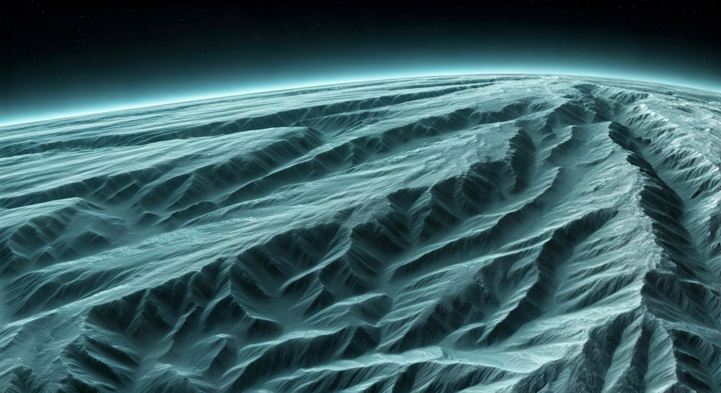
China's Tianwen-1 mission has successfully captured striking images of Noctis Labyrinthus, a complex network of canyons on Mars. The images were taken by the orbiter's high-resolution camera, providing an unprecedented detailed view of this significant geological feature.
Noctis Labyrinthus, often referred to as the "Labyrinth of Night," is located at the intersection of the Tharsis volcanic region and Valles Marineris. This region is characterized by a dense system of intersecting valleys and canyons, formed by tectonic activity and possibly influenced by past water erosion. The images from Tianwen-1 highlight the intricate patterns and steep walls of these canyons.
The data collected by Tianwen-1's camera is crucial for understanding the geological evolution of Mars. By studying the morphology and scale of the canyons, scientists can gain insights into the planet's tectonic history, the processes that shaped its surface, and the potential for past or present water activity.
This achievement underscores the capabilities of the Tianwen-1 orbiter and its scientific payload. The mission continues to contribute valuable data to the global scientific community, enhancing our knowledge of the Red Planet and supporting future exploration endeavors.
Tianwen-1's detailed imaging of Noctis Labyrinthus is a tangible step in our cosmic expansion. High-resolution mapping of Martian topography, particularly complex tectonic and potentially hydrological features like these canyons, is foundational for identifying future settlement sites. Understanding these geological formations allows us to assess resource potential and environmental hazards, crucial for establishing self-sustaining outposts. Each detailed image is a data point in the grand project of making humanity multi-planetary, accelerating our ability to engineer habitats and expand consciousness beyond Earth.
Edited by the news editor with AI and translated into English from the original report — please refer to the original source.