Psyche Spacecraft Captures Detailed Images of Mars During Flyby
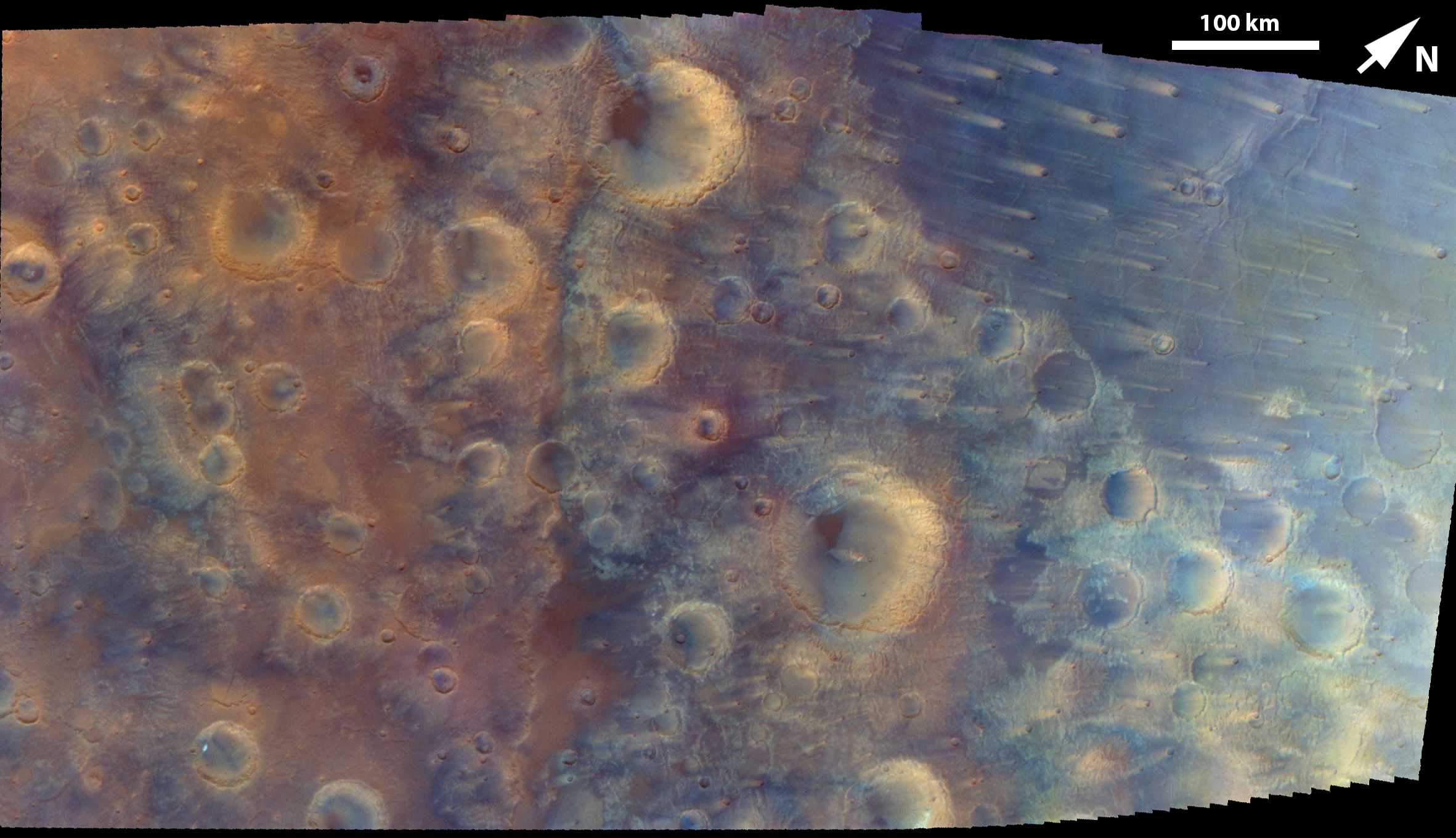
NASA's Psyche mission, en route to an asteroid, has returned enhanced-color images of the Martian surface, revealing geological details during a recent flyby.
During its journey to a metal-rich asteroid, NASA's Psyche spacecraft performed a flyby of Mars, capturing a series of detailed images of the planet's surface. These images, taken on May 15, 2026, were assembled into an enhanced-color mosaic by the mission's multispectral imager.
The spacecraft traversed the Martian landscape from northeast to southwest over a six-minute period to acquire the data. The resolution of the imagery varies across the mosaic, ranging from 381 meters per pixel on the right side to 440 meters per pixel on the left. The imager utilized near-infrared, green, and blue filters to highlight distinct surface features.
These filters allowed for the visualization of contrasting craters, ridges, wind streaks, and materials characteristic of volcanic plains. The mosaic focuses on a section of the Iapygia region, situated in Mars' southern highlands. This area is characterized by rugged terrain and is located between approximately 62 and 78 degrees east longitude and 4 degrees north to 14 degrees south latitude.
Prominent features within the image include Fournier crater, a significant impact structure measuring about 114 kilometers (71 miles) in diameter, positioned just below the center of the mosaic. A notable linear feature, running vertically to the left of the mosaic's center, is identified as part of the Oenotria Scopuli cliff system. This scarp is connected to the larger Isidis impact basin, located to the northeast of the observed area.
The Psyche mission's multispectral imager, by capturing detailed Martian surface imagery with varied filters, demonstrates the expanding capability of space-based instrumentation to resolve fine geological features. This data, gathered incidentally during a primary mission to an asteroid, underscores the efficiency of leveraging deep-space assets for multiple scientific objectives. For Mars, such high-resolution imaging contributes to a growing catalog of planetary surface data, crucial for understanding geological evolution and identifying potential resources. This continuous refinement in observational technology accelerates our capacity to map and characterize celestial bodies, paving the way for future exploration and eventual settlement, as humanity's multi-planetary destiny unfolds.
Edited by the news editor with AI from the original report — please refer to the original source.