New Mars Images Reveal Mysterious Rock and Ancient Terrain
NASA's Perseverance rover captured the sharpest Mars panorama yet, revealing a mysterious 'float rock' and ancient geological features.
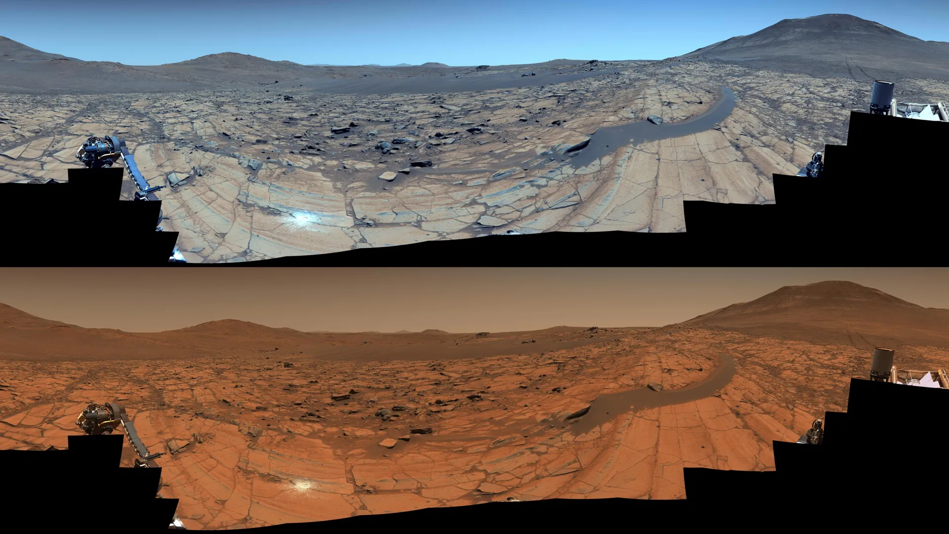
NASA's Perseverance Mars rover has captured one of the most detailed panoramas of the Red Planet to date, offering a clear view of a mysterious rock and ancient terrain. The high-resolution image, taken at a location called 'Falbreen,' includes a rock that appears to sit atop a sand ripple, a boundary between two distinct geological units, and hills up to 40 miles (65 kilometers) away.
The images, captured by the rover's Mastcam-Z instrument on May 26, 2025, during the 1,516th Martian day of the mission, were stitched together from 96 individual shots. The enhanced-color version highlights the clarity of the Martian sky, which appears unusually blue, while the natural-color version shows the familiar reddish hue of the planet.
Among the notable features is a large 'float rock' positioned above a dark, crescent-shaped sand ripple. Scientists believe this rock was transported to its current location, possibly by wind, water, or a landslide, and may have arrived before the sand ripple formed. The image also includes an abrasion patch, created by the rover's drill, which allows scientists to examine the composition of a rock beneath its weathered surface.
The panorama also reveals a transition from lighter-toned to darker-toned rocks, marking the boundary between two geologic units. The lighter rocks near the rover contain olivine, while the darker, more distant rocks are thought to be older clay-bearing formations. The area is among the oldest terrain Perseverance has explored, offering valuable insights into Mars' geological history.
This article was written by AI from the original report. The "AI Analysis" is opinion/commentary. Always refer to the original source for the complete, authoritative story.