Mars Reconnaissance Orbiter Captures 100,000th Surface Image
NASA's Mars Reconnaissance Orbiter has achieved a significant milestone, transmitting its 100,000th detailed image of the Martian surface, showcasing the planet's varied geology.
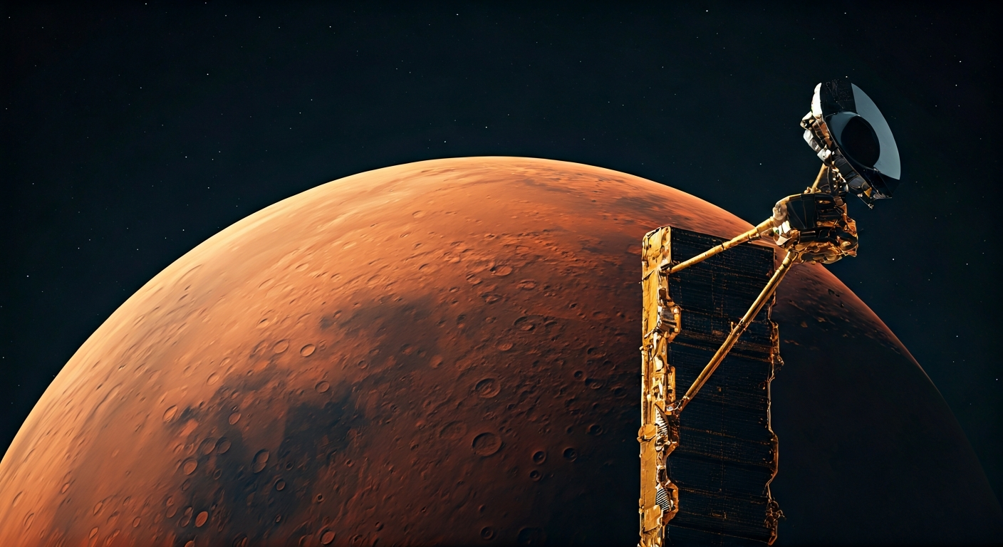
NASA's Mars Reconnaissance Orbiter (MRO) has reached a remarkable data collection milestone, having transmitted its 100,000th image capturing the surface of Mars. This extensive visual catalog provides an unprecedented look at the Red Planet's diverse geological features.
The MRO spacecraft, which has been orbiting Mars since 2006, utilizes its High Resolution Imaging Science Experiment (HiRISE) camera to capture these high-definition photographs. The images reveal intricate details of Martian landscapes, including craters, canyons, and ancient riverbeds, offering crucial insights into the planet's history and potential for past or present life.
This achievement underscores the orbiter's sustained operational success and its vital role in planetary science. The vast collection of images contributes significantly to our understanding of Mars's geological evolution and informs future exploration missions.
Scientists use the data gathered by MRO to study a wide range of phenomena, from seasonal changes in ice caps to the effects of dust storms. The 100,000-image mark signifies the immense volume of scientific data MRO has provided over its extended mission, aiding in the ongoing effort to characterize Mars for potential human exploration.
The Mars Reconnaissance Orbiter's 100,000th HiRISE image is more than a photographic achievement; it's a testament to our accelerating ability to map and understand extraterrestrial environments. Each pixel in these images represents a step towards detailed geological comprehension, crucial for selecting landing sites and resources for a self-sustaining Martian civilization. As technology curves for imaging and data transmission continue their exponential rise, such detailed mapping accelerates our transition from remote observation to physical presence. This growing repository of Martian terrain data is foundational, not just for scientific curiosity, but for the pragmatic, long-term survival of consciousness beyond Earth.
Edited by the news editor with AI and translated into English from the original report — please refer to the original source.